Our Solutions
Smart and climate-safe city systems


Using advanced AI/ML technology and intelligent DSS and BI engines

Real-time alerts on climate hazards and dangers to residents following the damage of the climate crisis

Interface and integration to all relevant sensors

An advanced and intuitive UI/UX interface within control centers in cities, countries and organizations
Advanced AI engine for urban damage alerts

Real-time alerts for horns, phones, messages, emails and video broadcasts

Specializing in flood defenses, urban flooding, environmental pollution and various damages

An advanced AI-based image processing application for urban and environmental damage analysis from images and camera broadcasts
The fire oracle system

The system can be activated as an application on mobile devices, tablets or at municipal operating stations

The system is presented intuitively (UI/UX) on GIS maps and satellite photos

The vessel is very accurate, connected to various sensors and calibrated atmospheric models

An advanced and smart system for warning about the damage and risks of wildfires spread in forests and the natural environment
The Aqua oracle system

The system enables research to be carried out for government and municipal preparedness against future flood hazards

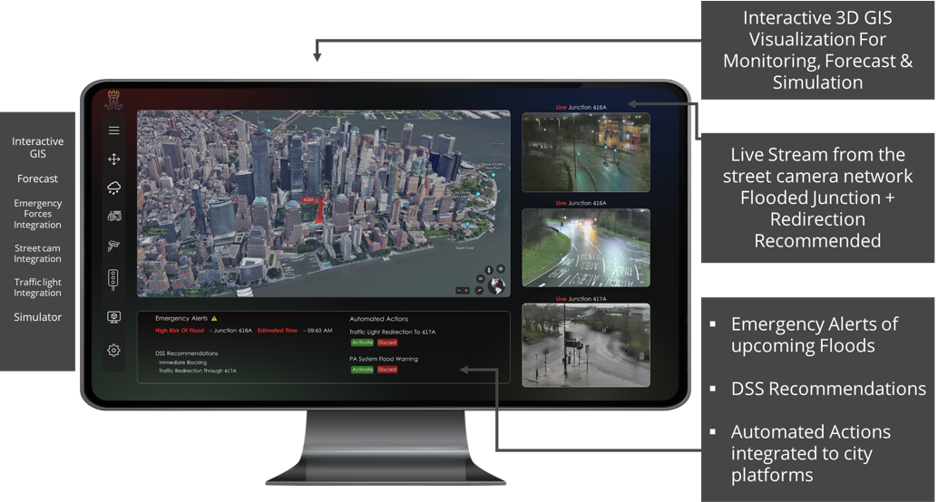
The system predicts effects in advance and warns in real time about flood dangers

An advanced WEB system based on GIS and atmospheric models for predicting the effects of floods and urban flooding in the urban, rural or agricultural area
The Clean Horizon System
A WEB system based on GIS and atmospheric models for predicting the effects of air pollution, industrial pollution and traffic pollution on urban life. The system is connected to all the sensors that exist today and warns of pollution damage and current and future effects
The Silver Falcon system
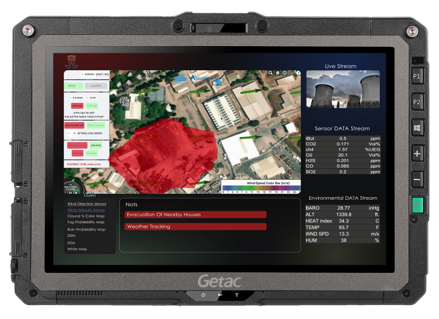
A system for first responders, fire brigades and safety officers in industrial plants and municipal authorities – for risk assessment, real-time intelligence, and decision-making in incidents of hazardous chemical spills in open and urban areas (HAZAMAT)
The system analyzes the gas and matter models, infuse them into a Data fusion engine of atmospheric models in real-time, and displays vector meanings & Icons on a GIS map


